 vesseltracker.com
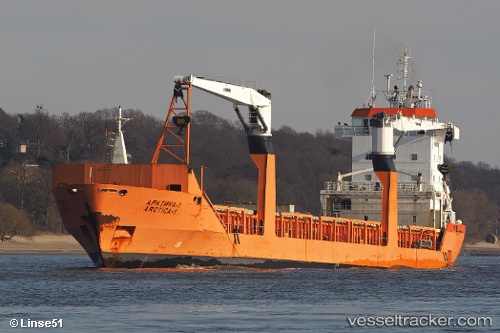
Vessel Arctica 1 IMO: 9228980, MMSI: 273386130 Multi Purpose Carrier
UTC, 64.56833, 40.50333, course: -1, speed: 0
UTC, 64.56833, 40.50333, course: -1, speed: 0
2026-02-22 18:45:52 UTC, 64.56833, 40.50333, course: -1, speed: 0
Live AIS position:
UTC. Near ARKHANGELSK),
updated 2026-02-22 18:45:52 UTC.
Find the position of the vessel Arctica 1 on the map. The latter are known coordinates and path.
marine traffic ship tracker show on live map
The current position of vessel Arctica 1 is 64.56833 lat / 40.50333 lng. Updated: 2026-02-22 18:45:52 UTCDetails:
Last coordinates of the vessel:
UTC, 64.56833, 40.50333, course: -1, speed: 0UTC, 64.56833, 40.50333, course: -1, speed: 0
UTC, 64.56833, 40.50333, course: -1, speed: 0
2026-02-22 18:45:52 UTC, 64.56833, 40.50333, course: -1, speed: 0